
Leave it to March to pick up February’s slack.
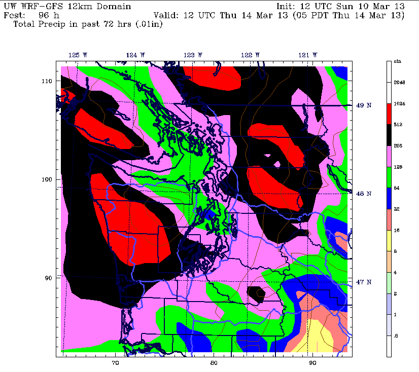
A torrent of moisture is forecast to unload on Western Washington this week, drenching the area with up to 2 inches of rain by Thursday. That’s more than what fell all of last month, when ’round-the-clock drizzle only added up to 1.58 inches—making February 2013 the seventh-driest February on record in Seattle.
Already, March has made it clear it won’t be following in its predecessor’s footsteps, with the 0.47 inches unleashed last Wednesday outdoing February’s soggiest day by a good tenth of an inch. That system helped bump our monthly rainfall total up to nearly an inch—an amount that will easily be doubled over the next few days, despite the rapid approach of spring.
The cause for all the storminess? A potent jet stream aimed squarely at the region, directing round after round of rainfall into our neck of the woods. The first batch arrives early Monday as a warm front approaches from the south, spreading light showers throughout the Sound. By mid-morning, the rain should pick up in intensity, continuing at a steady clip into the afternoon and evening. Expect close to half an inch of rain in Seattle by the time Monday ends.
The warm front slowly creeps up the I-5 corridor on Tuesday, shifting the strongest rains north of the city, but Seattle will still continue to see moderate rainfall at times. Amounts will range from half an inch along and south of I-90 to a quarter inch from North Seattle to Everett, where the Olympic rain shadow will be in play.
As the warm front stalls near the Canadian border Tuesday and Wednesday, mild air to the south surges into the area, allowing temperatures to jump into the mid 50s. Things stay on the balmy side even at night, with lows barely falling out of the 50s both days. The stormy March weather continues unabated on Wednesday, with bands of rainfall dropping another half an inch on Seattle—with twice as much possible for the Eastside.
We get one final soaking on Thursday before cooler and markedly drier conditions arrive in time for the weekend. By then, our waterlogged city should have collected close to 2 inches of rain—the biggest pummeling from Mother Nature since early January.
Evidently, March is bent on atoning big time for February’s dismal performance.


