
It rained hard enough in plenty of places overnight Tuesday into yesterday morning, but not where it counted.
At Sea-Tac Airport.
Seattle’s official weather-reporting site recorded just a trace of rain from nearby thunderstorms that lit up the region into the wee hours of Wednesday—an amount insufficient to halt the dry streak at the airport, which began on June 28. Odd as it may seem, it can actually rain on what’s termed a “dry day” around here, provided that the drops add up to less than .01 of an inch—an extremely miniscule amount referred to as “non-measurable precipitation,” or a trace. (During Seattle’s near-record 48-day dry streak last summer, a trace of rain was observed on four separate days.)
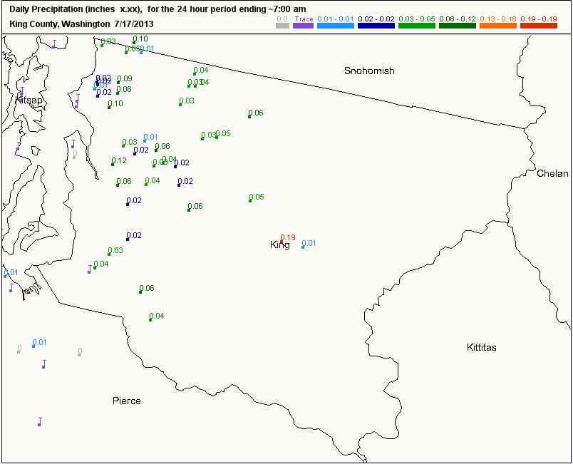
Many spots north of Sea-Tac—especially along and east of I-5—had little trouble getting more than that, with up to 0.12 inches recorded in Seattle proper as thunder crashed overhead. Regardless, the airport’s weather is what goes into the books, meaning July officially remains dry—with no additional storms on the horizon.
In sight, however, is another warm, sunny spell—following a one-day reprieve that saw the mercury top out at just 72 degrees yesterday. Stubbornly gray skies over Western Washington should give way to full-on sunshine later this afternoon, rebounding temperatures to the upper 70s by early evening.
Less cloud cover is anticipated tomorrow morning, allowing Seattle to creep into the lower 80s as high pressure strengthens overhead. That’s several degrees above the mid-July norm of 77, but in line with the balmy temperatures we’ve seen so far this month—through yesterday, July is running 3 degrees warmer than average.
It’s rinse and repeat for Saturday and Sunday, with plenty of sunshine and highs dancing around the 80-degree mark. The blazing blue skies and pleasant temperatures will make for yet another spectacular weekend in Seattle—the city’s fourth straight without any sort of rain.
Traces included.


