Baby steps, Seattle, baby steps.
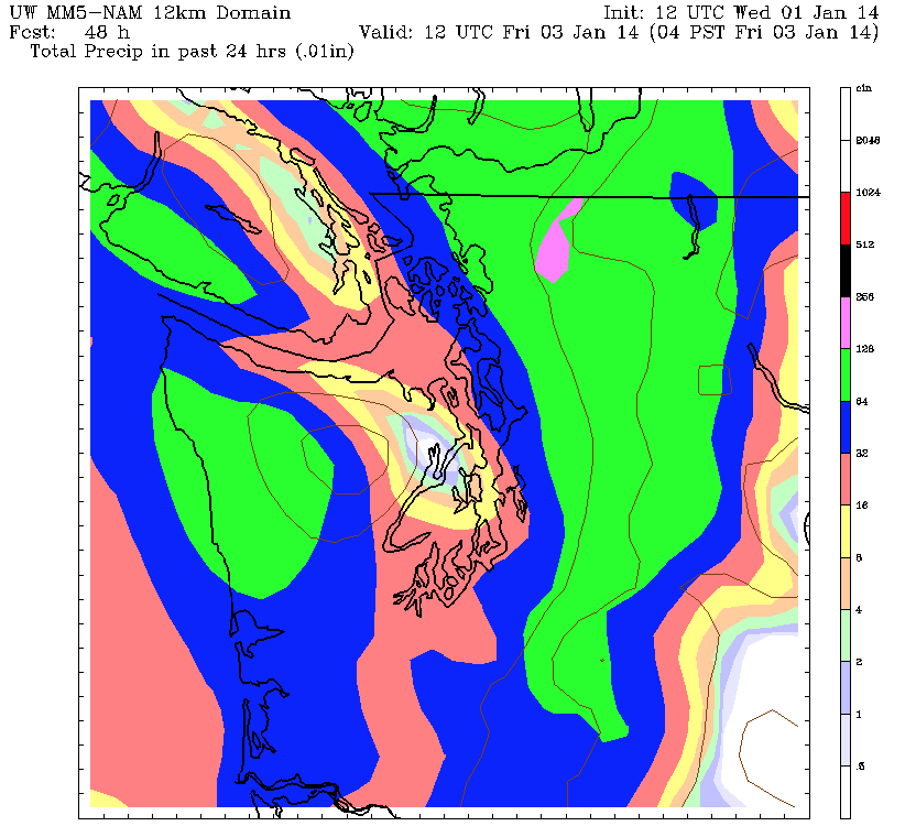
An approaching cold front is on track to bring us our first respectable rain event of the past ten days, dropping a quarter-inch of precipitation across the city tomorrow night into Friday. While that’s not much by our usual hefty standards, it’ll at least be enough to keep our winter rainfall deficit at bay for a few days—with hopes for a more widespread pattern change next week.
In the here and now, it’s another mixed bag of fog and sunshine, with some breaks in the overcast from Seattle northward, while the clouds hang tough over the South Sound and Eastside. Highs today will reach the mid 40s where the sun is more prevalent, with lower 40s where fog persists.
Spotty light rain is possible late tonight north of Seattle, but most of us will have to wait until Thursday to record the first drops of 2014. That’s when the cold front sweeps down from the northwest, ushering in a soggy evening for the metro area—a true rarity these past couple months.

Since the beginning of October, Seattle has seen just 7 inches of rain—less than half of the 15-plus inches we typically measure during the final three months of the year. Last month in particular was exceptionally dry, with the rain gauge at Sea-Tac Airport logging just 1.66 inches—the second-lowest total ever recorded there during the month of December. (Overall, when weather observations in the era before Sea-Tac are factored in, December 2013 amounts to Seattle’s 5th-driest December on record—in 122 years of record-keeping.)
The continuously dry weather has been due to an unusually stubborn ridge of high pressure off the West Coast that’s flat-out refused to leave the area. While a few systems have been able to shove it far enough away to allow for some rain at times, the ridge has always been able to magically reappear shortly thereafter. Naturally, this will be the case again with tomorrow’s rainmaker.
After dropping a much-coveted 0.25 inches of rain in Seattle late Thursday into early Friday—with half-inch totals further north—the high pressure ridge quickly resumes its old position, setting up a dry weekend across Western Washington. With a glancing blow of cold air sliding by to the east, highs will tumble to the lower 40s Saturday and Sunday. On the plus side, a fair amount of sunshine is likely both days, especially in the afternoons.
The ridge stays intact through Monday, but after that, it looks like we might finally transition back to a wetter regime. Long-range models show several bouts of rain (and mountain snow) beginning next Tuesday as the ridge crumples to our south—a forecast which will hopefully hold as time draws closer.
So that we can start taking bigger steps toward erasing our rainfall shortage.


