Seattle’s temperatures are greatly moderated by Puget Sound, the nearby Pacific Ocean and the Cascade mountain range, all of which generally protect the city from the scorching heatwaves and bitter cold that often wreak havoc in other parts of the country. The average daily high temperature in Seattle ranges from a peak of 77 degrees from July 19-Aug. 16 to a minimum of 45 degrees from Dec. 14-30. In similarly mild fashion, the normal low temperature in Seattle runs from 35 degrees from Dec. 11-25 to 57 degrees from July 27-Aug. 6.
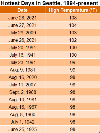
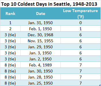
However, Seattle is not entirely immune to extreme temperatures on both sides of the spectrum. This was demonstrated all too clearly recently, when the mercury soared past the century mark three days in a row, peaking at a staggering 108 degrees on June 28, 2021. Likewise, on Jan. 31, 1950, in the midst of a bone-chilling arctic blast, the temperature plunged to 0 degrees at Sea-Tac Airport—the city’s coldest temperature on record.
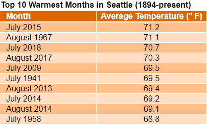
The graphs below show the warmest and coldest days—as well as the warmest months—observed in Seattle since record-keeping began in the 1890s. Weather observations were taken at the Federal Building in downtown Seattle until 1945, when Seattle’s official weather station was moved to Sea-Tac Airport.