
Hold on to your hat—a double whammy of wind is in the cards this week.
After a blustery Saturday that saw Seattle record its top wind speed of the month so far—Sea-Tac Airport clocked in at 37 mph just before 6 p.m.—breezy conditions are due back in the metro area late tonight, and again on Wednesday. Both times, gusts could howl to 30 mph, with the winds on Wednesday potentially topping 40.
We’ll catch a break in the action this afternoon, with partly sunny skies and lighter winds across most of Western Washington, save areas of the South Sound, where it’ll still be on the breezy side. Shower activity will be limited to the mountains, but with a cold upper trough still draped across the state, it’ll stay on the cool side. Highs should max out near 50 degrees—below the norm of 53.
Hats go flying again late tonight as the winds rev up once more, blowing to 30-35 mph into the early morning hours on Monday. The strongest gusts will be along the shoreline of Puget Sound and southeast of Seattle, especially near Issaquah and the Sammamish Plateau.
By mid-morning, the winds should die down considerably, and with a ridge of high pressure moving in, some sunshine is likely by lunchtime. Highs will warm up a few degrees into the lower 50s.
The calm weather holds over into the first half of Tuesday, before a strong area of low pressure barreling toward Vancouver Island changes things in a hurry. By mid-afternoon, rain should spread into the state from south to north, becoming moderate to heavy as the low approaches. The winds will also start to really pick up north of Everett, howling out of the southeast throughout the night.
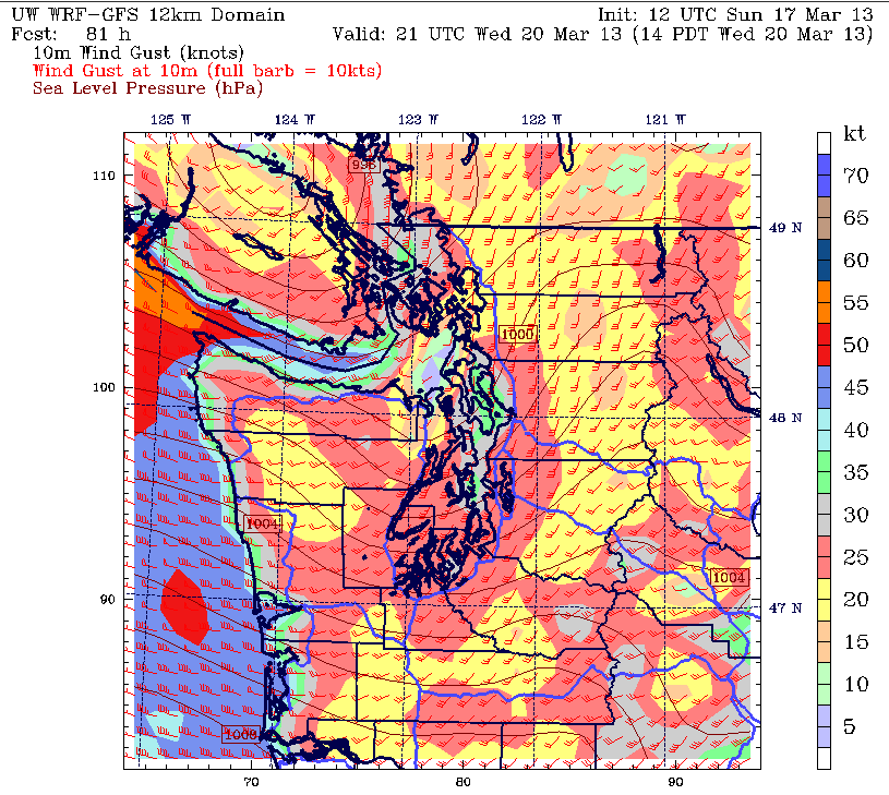
The powerful low is likely to slam into the northern tip of Vancouver Island around sunrise Wednesday, before racing off to the northeast. As the low moves due north of Seattle around noontime, strong winds will shoot up the I-5 corridor, rocking the Sound with gusts as high as 40 mph. Needless to say, it won’t be a good day for hat lovers.
Another round of moderate rain is also likely across the metro area during the morning hours on Wednesday. Combined with the expected soaking Tuesday night, this should bump the rainfall total from the storm above half an inch—making for our soggiest system since Mar. 6-7, when 0.76 inches fell.
The heavy rain is history by Thursday, with just a few showers lingering in the storm’s wake. The wind will also make a hasty retreat—no doubt perfect timing for many in the city.
After all, who would want to kick off the first full day of spring—the unofficial start of baseball season—without a cap?


