
Even the wind has to go back to work tomorrow.
Fresh off a weekend largely devoid of blustery weather, gusty winds are back in the forecast for the start of the workweek—potentially reaching speeds even higher than last Friday’s.
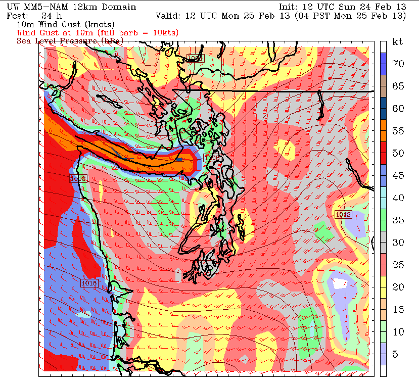
The culprit? Another powerful cold front, due to race across Puget Sound just before midnight. Once the front barrels through, strong winds will rapidly pick up out of the southwest, roaring well above 40 mph throughout the early morning hours. In light of this, the National Weather Service office in Seattle has placed the I-5 corridor under a wind advisory, with gusts up to 55 mph possible Monday morning.
Already, breezy conditions are on the rise to the north of Seattle, with winds blowing past 20 mph in the San Juans and Whatcom County ahead of the front. Light rain is also likely in these areas later this afternoon, with places to the south—including the Seattle metro—skating by dry.
The clouds will continue to thicken over the Central Sound as the day progresses, however, capping our high temperatures in the upper 40s. The rain should arrive by 9 p.m. tonight as the cold front passes the coast, with the bulk of the moisture falling between then and 1 a.m. Amounts will average around a quarter inch—not quite as wet as the .37 that fell on Friday, but noticeable nonetheless.
The rain tapers off early tomorrow morning as the winds turn gusty, reaching their peak around 5 to 6 a.m. In the Seattle area, the strongest winds will be south and east of the city, where gusts could top 45 mph. Blustery conditions will also rake areas north of Everett, with 60 mph gusts possible in spots like Whidbey Island as high winds howl down the Strait.
The wild weather subsides later in the morning, although Seattle should remain on the breezy side well into the afternoon. Showers are also likely over Snohomish County through the early evening hours as another Puget Convergence Zone sets up shop.
By Monday night, calm winds and overcast skies should prevail across all of Western Washington, extending through most of Tuesday as well. High temperatures will hover around 50 degrees, with overnight lows near 40.
Late Tuesday, a much weaker system moves through, sprinkling Seattle with a tenth of an inch of rain, before dry conditions set in on Wednesday. Another fizzling front is expected to arrive sometime on Thursday, with showers holding over into early Friday. Notably, to the relief of wind-battered Seattleites, neither of these systems will feature much more than a light breeze.
Guess a full-on workweek was a bit too much for the wind, huh?


