
Summer may have stalled recently, but rest assured it’ll be kicking into high gear soon.
If not overdrive.
A mammoth ridge of high pressure currently scorching the Southwest is forecast to nudge into the neighborhood early next week, catapulting temperatures to near 90 degrees throughout the Sound. Seattle’s daily record highs for both Monday and Tuesday could fall by the wayside as the city threatens to reach the 90s in July for the first time in three years.
But first, a nod to a different kind of record.
0.39 inches of rain landed in the gauge at Sea-Tac Airport yesterday, establishing a new high-water mark for Seattle’s wettest June 25. The rainfall, fueled by a band of thunderstorms that blasted through yesterday afternoon, was just enough to beat out the 0.36 inches that fell in 1980—giving Seattle its second daily rainfall record of the year. (April 7, with its 1.54-inch deluge, was the first.)
Today fared much calmer around the city, with just 0.08 inches on the books—although parts of the South Sound did get hit with a pretty hefty shower in the afternoon. Overnight, the entire region will get a chance to catch its breath, before a final round of moisture rolls in by sunrise tomorrow. Like the past few days, the rain could be moderate to heavy at times, with another quarter-inch or so for much of Western Washington.
Skies begin clearing in earnest tomorrow afternoon as low pressure off the coast hightails it to the west, allowing temperatures to tick up a few degrees. Highs tomorrow should top out in the mid 70s, with overnight lows again staying on the warm side—i.e., the upper 50s.
On Friday, the ridge of high pressure centered over the Four Corners region shifts further northwest, sending the mercury into the 80s for the first time since June 6. The day should be mainly sunny, with a few high clouds floating by at times. Saturday looks remarkably similar, with sunny skies and highs again reaching the lower 80s.
Things rev up a couple notches on Sunday as the ridge bulges northward, taking plenty of heat with it. Seattle should easily climb to the mid 80s—making the final day of June the hottest.
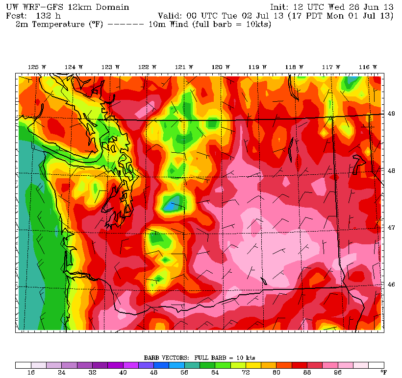
It’s off to the races come Monday and Tuesday as high pressure bears down overhead. Temperatures should flirt with 90 degrees both days, with Tuesday likely to wind up the toastier of the two. The record high for Monday—87 degrees, from 1995—stands a good chance of being beat, with Tuesday’s 45-year-old record of 92 also on the line.
Suffice it to say, summer is about to hit full throttle.


