It’s not often that a day nearly ten degrees above normal would be considered on the cool side of things.
Relative to what’s coming, though, how else to describe Thursday’s high of 84?
A mammoth ridge of high pressure bubbling up from our southeast will send temperatures soaring into the low 90s starting this weekend and continuing through much of next week, making Seattleites long for the refreshing mid-80s of yesterday.
The ramp-up is already under way today, with temperatures perched in the lower 80s as of 1 p.m. That’s a good 7 degrees above the average mid-July high of 75—with several hours of prime-time heating left. Expect highs this afternoon to reach the upper 80s.
Tonight will mark the first of several increasingly balmy nights, with overnight lows only dipping into the low 60s—versus the norm of 55. The warm temperatures carry over into tomorrow morning, allowing us to quickly rise into the 80s by early afternoon—and to a toasty 90 degrees by early evening. (The record high for the day is a scorching 97 degrees from 1961—a mark we’ll thankfully fall short of.)

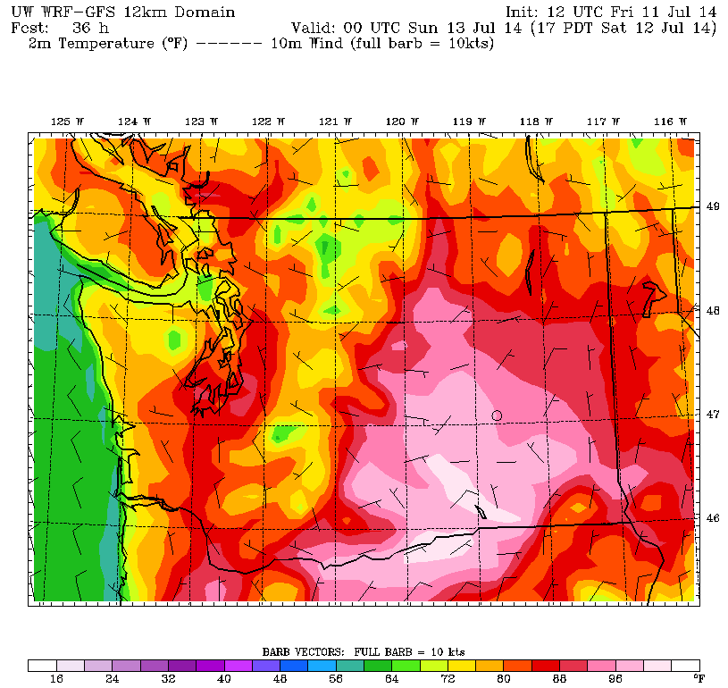
We dial up the warmth a little more on Sunday, with the mercury jumping into the lower 90s—putting us within striking distance of July 13’s record high of 93 degrees, also set back in 1961. The day should start off bright and sunny, but things will turn hazy by the afternoon as a band of clouds drifts up from Oregon. With the upper-level winds blowing out of the south, it’ll become increasingly humid as warm, moist air gets drawn into the region. Isolated thunderstorms will even be possible, although the best chances for these will be over the Cascades and further south toward Portland.
The clouds wash away on Monday, but the hot weather won’t be going anywhere. Instead, we’ll flirt with the lower 90s for a third straight day, simultaneously challenging another daily record high (91 degrees from 1996). Tuesday and Wednesday promise to be no different, with the strong ridge of high pressure overhead giving us two more days of blazing 90-degree heat.
We finally look to cool off somewhat next Thursday as lower pressure approaches, allowing a little more marine air to trickle into the Sound. This should knock high temperatures down a bit into the mid 80s—still rather warm by most Seattle standards.
Just not by July 2014’s, where 84 degrees is becoming the new benchmark for cool weather.


