
It’ll be a Groundhog Day worthy of repeating.
The warmest temperatures of the winter season are headed for Western Washington on Saturday, with a healthy dose of sunshine in tow. Bolstered by partly sunny skies, thermometers across the region are expected to jump into the mid 50s—making for a pleasant day that even Bill Murray’s character in the film “Groundhog Day” would want to relive.
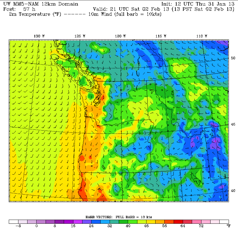
The long-overdue mild weather—the last time Seattle reached 55 degrees or higher was Dec. 1, when we squeaked to 56—comes courtesy of a ridge of high pressure at the surface that will park over Eastern Washington later in the day tomorrow. Coupled with lower pressure off our coast, this will allow the winds to reverse course and blow from east to west over the Cascades, pulling warmer air into the Sound.
Before then, however, there’s still a risk for some scattered showers, especially north of Seattle and on the Eastside. High temperatures the rest of today will remain steady in the upper 40s—average for the end of January. With the rainfall of the past few days not as heavy as anticipated, the month will close out notably drier than average—as of noon today, 4.12 inches of rain has fallen, compared to the typical 5.57 for January.
We dry out completely early tomorrow, with any lingering showers moving out for good by sunrise. As drier air begins filtering into the region, some breaks in the overcast are likely later in the day. With high pressure building east of the mountains, temperatures will inch up into the lower 50s.
Some clouds are still likely on Groundhog Day morning—Punxsutawney Phil would have difficulty seeing his shadow in Seattle early Saturday—but by noon, things will tip toward the sunny side. This should help boost temperatures well into the mid 50s for the I-5 corridor, with places like Enumclaw and North Bend making a run at the 60-degree mark. In the immediate Seattle area, highs should top out in the 55 to 57 range.
Alas, this isn’t Hollywood, so there won’t be any replay of Groundhog Day’s weather for Sunday. Instead, a weak front will skirt the state, dumping most of its rain along the Canadian border, but bringing back plenty of clouds into the metro area. High temperatures will also sink into the upper 40s.
Light showers are possible again Monday and Tuesday, before a wetter and cooler system approaches on Wednesday. By the middle of next week, temperatures will struggle to reach the mid 40s as chillier air slides into the region—making Saturday’s balmy conditions a distant memory.
If only we could make like Bill Murray and dial up the weather from Groundhog Day again.


