Clearly, Mother Nature must have a heart.
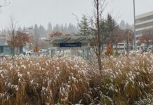
| Snow-covered trees in Issaquah. The city received about three inches of snow Sunday. |
Tonight, Mother Nature will make sure that no one shares in the glory of the white stuff, as the dynamics associated with today’s snowfall have shifted south into Southwest Washington and the greater Portland area. Skies will clear partially tonight as drier air moves in from the north, causing the mercury to plummet into the upper 20s as nightfall sets in.
Tomorrow will begin partly sunny, before clouds stream in from the north as another potential snowmaker slides toward Western Washington. The exact track of this “snowmaker”–a surface area of low pressure, really–will be of the utmost importance for the Seattle area tomorrow afternoon. Some models send this low through Bellingham, meaning snow chances would be confined to the Northwest Interior. Other models drop this low much further snow, putting the metro area under the gun for another one to four inches of snow mid-afternoon.
In either case, tomorrow will certainly be chilly, with high temperatures struggling to top the mid-30s. Lows will again fall into the 20s Monday night, meaning any snow that does fall tomorrow afternoon will stay on the ground (just like tonight’s).
Much of Tuesday will be the calm before the storm (and it could be quite the storm), with high clouds and brisk winds on the increase as a moisture-laden front approaches from the coast.
It’s Tuesday night when things really start to get exciting around here! Current models indicate the potential for four to eight inches of snow across the greater Seattle area, as the warm, moist air from the approaching storm “overruns” the cold, dry air in place. This snow is likely to fall starting late Tuesday night, continuing well into Wednesday morning, before gradually changing to rain Wednesday afternoon.
Some models, however, insist that there will be no warm up with this system–rather, we’ll stay all snow, all day. If that’s the case, snow totals from Wednesday’s storm could be approaching ten inches in places by the time the evening commute rolls around. At this point in time, I would bet on a “snow changing to rain” scenario rather than the “snowpocalypse” scenario just described.
Either way, additional snowfall Tuesday night into Wednesday is almost a given, as our snowy stretch refuses to go out without a bang. Stay tuned!


