
Call it the calm after the storm.
In the wake of a strong Puget Sound Convergence Zone that stalled over the Seattle area last night, swamping some spots with half an inch of rain, partly to mostly sunny skies have settled in across the region. With no wet weather expected until Tuesday, sunshine will be the rule of thumb for the next 36 hours, with temperatures rising well into the 50s tomorrow.
But first, it’s going to get cold.
With clear skies and a cooler air mass just to our east, the mercury will drop sharply from the mid 40s this afternoon into the upper 30s after sunset, plunging all the way to the freezing mark by early tomorrow. For Seattle, this will make for our chilliest morning since we bottomed out at 29 degrees on Jan. 22—at the tail end of the January fogmaggedon. (Amazingly, we went the entire month of February without a single freeze—the lowest temperature recorded was a wimpy 34 on the 20th of the month.)
After the cold start, however, ample sunshine and a ridge of high pressure overhead will combine to send temperatures into the low to mid 50s by the afternoon. While it won’t be as warm a day as it was on Friday—Seattle hit 59 then, our balmiest reading since reaching 64 in early November—it’ll be far sunnier, with just a few high clouds passing by later in the day.
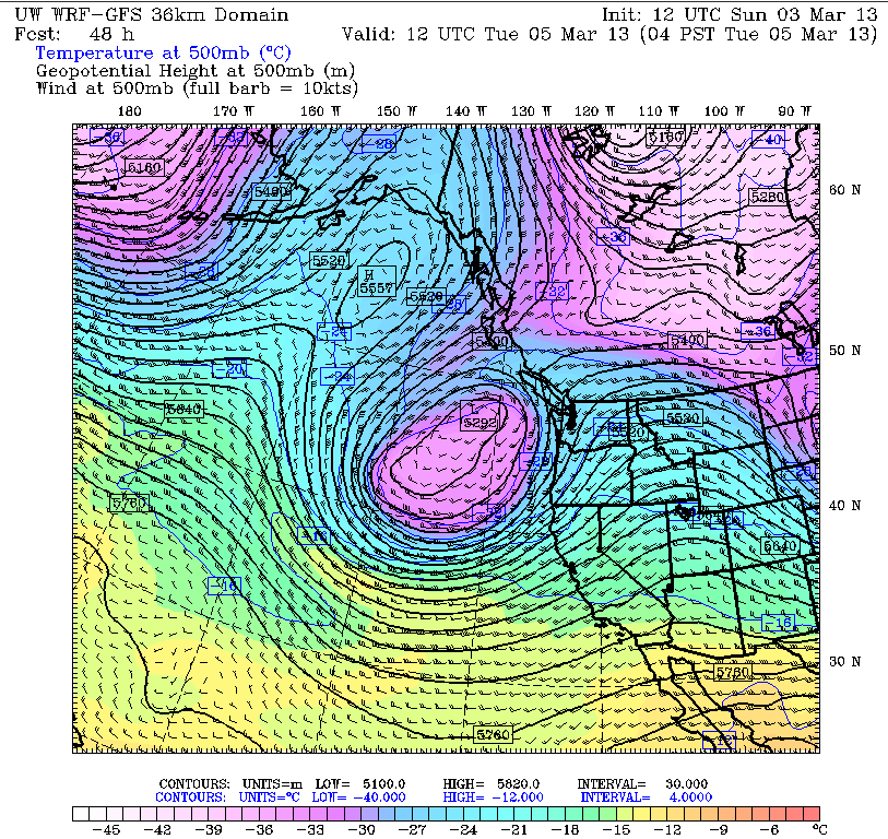
Unfortunately, the sun disappears in a hurry early Tuesday as an upper level area of low pressure approaches from the west. The center of the upper level low—a pesky feature capable of generating intense downpours and even thunder and lightning—is expected to park off the central Oregon coast, lashing areas from Eugene to Medford with the heaviest rains. However, we’ll still get a good soaking in the Seattle area, with a steady stream of moisture blasting through mid-day Tuesday.
Additional rounds of rain will spin into the region from the southwest through Wednesday, with the proximity of the low holding temperatures below the 50-degree mark. Between the showers, however, we’ll see plenty of sunbreaks, as our weather swings from wild to mild and back again throughout the course of the day.
The low drifts further south into California on Thursday, cutting off rainfall over Puget Sound and warming us back to the plus-side of 50 degrees. With high pressure in control, slightly above average temperatures and partly sunny skies will continue all the way through Saturday.
Nothing like a storm to give us some quiet weather, huh?


