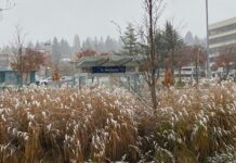
After today’s strong Puget Sound Convergence Zone, which decorated areas along and north of a U-District-to-Highway 520 line with a slushy inch or two of the white stuff, the focus turns to tomorrow morning’s expected snowfall. Unlike today’s snow, which focused mostly on the northern half of the metro area, tomorrow morning’s snow is expected to affect the majority of the Seattle metro.
 |
| 24-hour snowfall total through 4 p.m. Sunday. 1″ for Seattle, 2″ for the suburbs. |
Light snow should begin falling around sunrise, lasting until about noon or so. Although the snow tomorrow will be more widespread in nature, it does not look particularly heavy. Seattle proper should see about an inch, with amounts gradually increasing in the city the further north you go.
Par the course, Downtown Seattle will be ground zero for, well, pretty much zero accumulation! Neighborhoods within the city with some elevation–Queen Anne, Phinney Ridge, and much of North Seattle–are likely to pick up about two inches by the time we close in on the evening. The same holds true for much of the surrounding Eastside–two, perhaps even three inches, are likely for areas east of Lake Washington with a little elevation.
Temperature-wise, we’ll be stuck a degree or two above freezing for much of the day, meaning that it’ll take a little work to get the snow to stick to roads and sidewalks. Snow-covered roads are more of a threat to the north, where slightly cooler temperatures could lead to as much as six inches of snow piling up from Everett to Stanwood (I know, I know–big surprise)!
By Sunday night, the snow will be tapering off from Everett to Tacoma, and we’ll be left with temperatures hovering around the freezing mark under partly cloudy skies. Monday offers a reprieve from this weekend’s flirtation with the flakes, before a deepening area of low pressure approaches the coast Tuesday night.
If this low can manage to come inland anywhere from the mouth of the Columbia to the central Washington coast, the Seattle area could be in for quite the doozy Tuesday night and Wednesday morning, as a heavy slug of moisture collides with cold air in place over the region. Models Saturday night have been waffling on the exact track of this low, so the jury’s still out on this one.
The verdict for tomorrow’s snow, however, appears final–make sure to get up in time to see the flakes fly!


