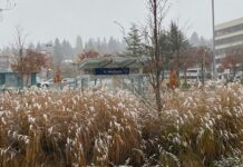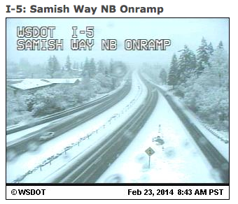
It’s a winter wonderland—up north.
Snow is falling from Whatcom County to the San Juans today as cold air blasts into the northern reaches of the state, colliding with a warm front shuffling east. Already, most of the Bellingham area has received over 3 inches, with additional bands of snowfall—heavy at times—expected through late tonight.
Further south, in the greater Seattle-Everett-Tacoma area, it’s a much different story, with temperatures holding steady in the low- to mid-40s amid light rain. Although precipitation is set to intensify within the next few hours, it’ll nonetheless remain in the form of rain rather than snow.
Why the stark discrepancy in weather over Western Washington? It all has to do with what’s known as Fraser River outflow—or, in Seattle’s case, the lack thereof. When we have arctic high pressure over B.C. and low pressure off the Washington coast, as we do today, the difference in pressure causes cold air on the eastern side of the Coast Mountains (Canada’s version of the Cascades) to be pulled westward into the Bellingham area through the Fraser River Valley—essentially a gap in the mountains northeast of the city.
If the pressure difference is strong enough, the frigid air—marked by blustery northeast winds—can trickle all the way down to Puget Sound, dropping temperatures to the freezing mark in Seattle and setting the stage for snow (if there’s moisture lurking nearby). In today’s case, though, the difference in pressure—or Fraser River outflow—is not strong enough to bring the cold air that far south, with any snow accumulations expected to stay north of Skagit County. (This is a big change from earlier thinking, where it looked freezing temperatures would creep into the Seattle area by later tonight.)
Instead, we’ll be left with plain old rain the rest of the day, with highs in the 40s and lows in the upper 30s. Roughly a third of an inch should fall in Seattle by early tomorrow, bumping the monthly rainfall tally past five and half inches—now our wettest February since 1999.
After a midday break, another shot of moisture pushes in from the west tomorrow night, dropping a quarter-inch of rain in the bucket. We then dry out nicely for Tuesday and Wednesday, with a little sunshine boosting high temperatures into the mid 50s for the middle of the week.
Hey, if it’s not going to snow, we might as well get in on some warmth, right?

