
Welcome to the club, D.C.
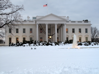
What was supposed to be a blockbuster snowstorm for the national’s capital failed to materialize today, dropping less than an inch in the city as a rain/snow mix—at times just plain old rain—made a mockery of predictions calling for up to 10 inches of the white stuff. Naturally, by the time it became apparent that the heavy flakes weren’t going to fly, it was too late—virtually all school districts in the region, as well as the federal government and many local businesses, had already made the decision to close for the day.
Sound familiar, Seattle?
It may seem like a while back, given the lack of snow we’ve received this winter, but it was just two years ago, in February 2011, that a similarly snowy forecast for Seattle went awry. Over six inches was predicted to fall on Feb. 23, but shadowing from the Olympic Mountains severely cut back on Seattle’s totals, giving most spots in the city less than an inch of snow. Even more infamously, a storm poised to dump several inches on the area led Seattle to shut down its schools on Dec. 17, 2008. The only problem? The snow didn’t arrive for another 24 hours, giving thousands of schoolchildren a day off to revel in nothing more than overcast skies.
To be fair, Seattle was blitzed by snowfall shortly thereafter, with a parade of storms rolling through the region from the 18th through Christmas Day. In Washington, D.C., with spring right around the corner, it’s highly unlikely the stars will align to bring additional snowfall to what’s been a lackluster winter for the city. Of course, that makes for another common bond between us and the “other” Washington—both cities have suffered through dismal snow seasons averaging roughly 10 percent of normal. (D.C. has logged 1.7 inches, compared to their average of 14.5, while Seattle has only seen 0.6 inches, against our 5.9-inch winter norm.)
Not surprisingly, there’s no snow in the Seattle forecast whatsoever, with just light rain and temperatures in the mid 40s expected tonight and early Thursday. Later tomorrow, the upper level low responsible for today’s showers scoots off to the south, drying us out for the afternoon.
Friday and Saturday promise to be nicer, with partly sunny skies and high temperatures bouncing back into the low to mid 50s. Overnight lows will drop into the mid 30s both nights, thanks to clearing skies and high pressure overhead.
The soggy weather returns later on Sunday, with moderate to heavy rainfall possible Monday and Tuesday as several storms come at us from the Pacific. With Western Washington expected to lie on the warm side of the jet stream, temperatures should remain in the mid 50s as we head into the final week of winter—a winter that, by most accounts, never really showed up.
Hey, at least D.C. knows how it feels now.


