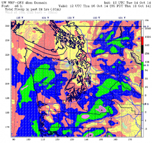
This time around, everyone got a piece of the pie.
A strong October cold front blew through the Sound overnight, dumping a half-inch of moisture across the region and ensuring that no local rain gauges woke up starved. That’s in sharp contrast to what happened on Saturday, when a round of late-day thunderstorms drenched some parts of the area, while leaving other spots largely high and dry.
Naturally, now that we’ve all shared in the wealth, it’s back to more hit-and-miss showers for the next few days.
The front that brought the widespread rainfall—Seattle officially logged 0.55 inches from yesterday evening through early this morning—has since trekked off to the east, leaving us with cloudy skies and cooler temperatures. Highs today will level off in the low 60s—far more in line with seasonal norms than yesterday’s peaking reading of 70 degrees.
As for any additional moisture? We’ll largely hold off on anything noteworthy the rest of the day, with just a few light showers here and there—but of course, not everywhere. The best odds will be to our south and west, especially near the coast.

Rain chances ratchet up on Wednesday as a healthy band of showers works northward from Oregon, arriving in the greater Seattle area around lunchtime. Brief, but heavy downpours are possible, along with an occasional rumble of thunder. However, much like Saturday’s storms, not everyone will get hosed equally—with some places skating by with a tenth of an inch or less.
The sun comes out for everyone on Thursday as we catch a break between systems, allowing temperatures to nudge back into the mid 60s by the afternoon. The clearing will be short-lived, however, as another front approaches from the west. While the bulk of this storm will slam into Vancouver Island, we’ll get enough of the remnants to make for a rainy Friday—to the tune of a half-inch or so.
Seattle should dry out considerably on Saturday as an upper-level ridge noses up from the south, sparing us any more precipitation for the next 24 hours. Highs will again hover in the mid 60s—several degrees warmer than normal.
We then return to our soggy ways by late Sunday as the ridge gets shoved east, opening the door to another round of moisture. Rain should spread across the entire metro area by Monday morning, making for a damp start to the workweek.
Hey, at least we’ll all be in it together again. After all, who wants to eat a whole pie by themselves?


Any cold weather coming our way in the next two weeks?
Is there any way you could do a *Snow Day* history of the longest Seattle Public schools *and maybe even outlying districts* have closed for snow?
Some sites on Google like Buffalo Public Schools you can find out historically how often they have closed over the last 30 years. They have data back to the early 90s.