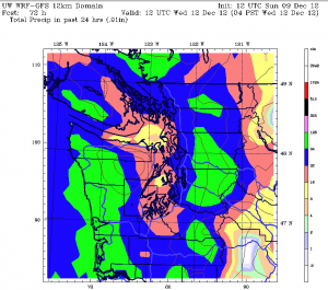
Two out of three ain’t bad, right?
Light rain has interrupted the dry weather that began in the metro area yesterday—the first rain-free day of the month in Seattle—but it’ll be gone by the time Monday rolls around, giving us our second dry day of the past three.
Going back even further, it’s been relatively dry around here since last Wednesday, with no more than .06 inches of rain falling on any day between now and then. The calmer, quieter weather stands in stark contrast to the driving rains that pummeled the Sound early last week, dropping 2 inches of rainfall on Seattle in the first four days of the month. Even now, despite almost a week of tranquil conditions, December’s rainfall tally remains solidly above average, with 2.18 inches in the gauge at Sea-Tac since the month began.
We won’t add much to this total the rest of the day—maybe another tenth of an inch at most—as the warm front moving through Western Washington right now is fairly weak. In addition, rainfall amounts will be held down in the immediate Seattle area by rain shadowing off the Olympics. To the east of the city, the rain shadow won’t play as large of a role, leading to more persistent rains.

All areas will see an end to the rain later tonight, with cloudy skies holding overnight temperatures in the low 40s—much warmer than the average low of 36 degrees. (Interestingly enough, Seattle has yet to record an average low temperature this month, with every overnight low so far remaining on the plus side of normal.)
A couple sunbreaks are possible on Monday, but by and large it’ll be a cloudy day, with high temperatures in the mid 40s. The highlight, though, will be the lack of rain, courtesy of a temporary ridge of high pressure.
The ridge is history by Tuesday as a strong cold front blasts into the region, dumping a solid half-inch of rain on Seattle and higher amounts to the south and east. Tuesday’s rainfall should be the most we’ve seen since, well, last Tuesday, when .56 inches of rain doused the city.
Another Puget Sound Convergence Zone forms behind the front Tuesday night, and it’s likely to last well into Wednesday, making for widespread showers from Everett to Seattle and points east. Colder air will also pour in behind the front, dumping more heavy snow in the mountains on Wednesday—and potentially dropping our nighttime lows below average for the first time this month.
As for the rain? After a wet Tuesday and Wednesday, Thursday has a decent chance of steering clear of the raindrops during the day, before wet weather resumes at night.
In other words, 2-for-3 will become 0-for-3 by the middle of the week—so enjoy Monday while you can.


