
The Vancouver Winter Olympics were only a year in the rearview mirror. Russell Wilson was still in college. Barack Obama was barely halfway through his first term as president.
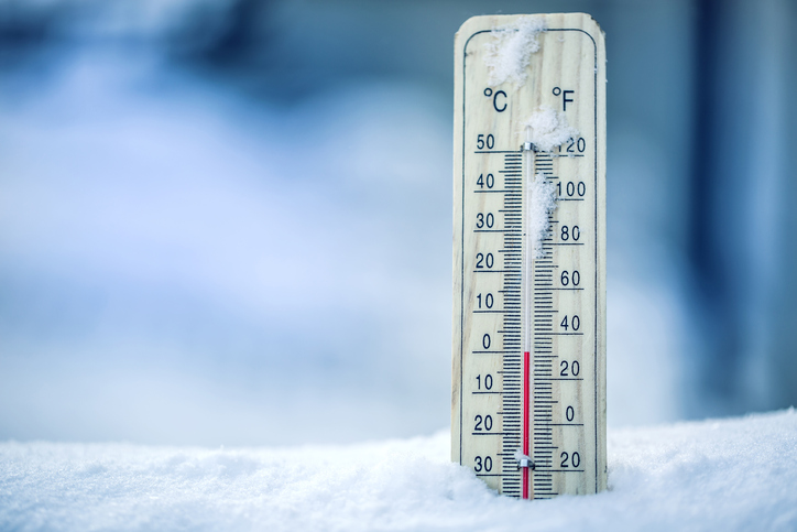
And in Seattle, it was a frigid late February morning, with the mercury plunging to 20 degrees—establishing a new record low temperature for the day.
Nearly seven years have come and gone since Feb. 25, 2011, and not once has Seattle set a new record low temperature. Not in January 2012—when snow and ice laid siege to the city for nearly a week, or in February 2014, when the high temperature didn’t crack 30 for a day. Not even last winter, which was our coldest in 32 years. For comparison’s sake, we’ve set (or tied) record highs 69 times since then.
Could this dubious—or blissful, depending on your preference for cold—streak finally be coming to an end?
It sure looks possible.
Almost all forecast models are in agreement that a massive burst of cold air will overtake the area on Sunday, as an arctic front barrels down from Canada. As the front sweeps into Puget Sound from north to south, temperatures will nosedive—going from near 40 degrees around sunrise to the 20s by sunset.
In addition, snow will be possible as chilly northerly winds slam into warmer, moister air from the south—although the jury is still out on whether or not it’ll be cold enough for snow (versus rain) at the time this occurs. Anyone along the I-5 corridor could see a quick few inches of snow Sunday morning—but the odds are highest north of Seattle (especially from Shoreline to Everett and points east), where a Convergence Zone is most likely.
Any snow showers will quickly wrap up by Sunday night, and then the freeze is on. With an arctic air mass in place, temperatures should tumble into the mid-20s—amid a bitterly cold wind. The record low for Sunday of 20 degrees won’t be touched, but Monday morning lows could come within striking distance of the Feb. 19 record (22 degrees from 1990).
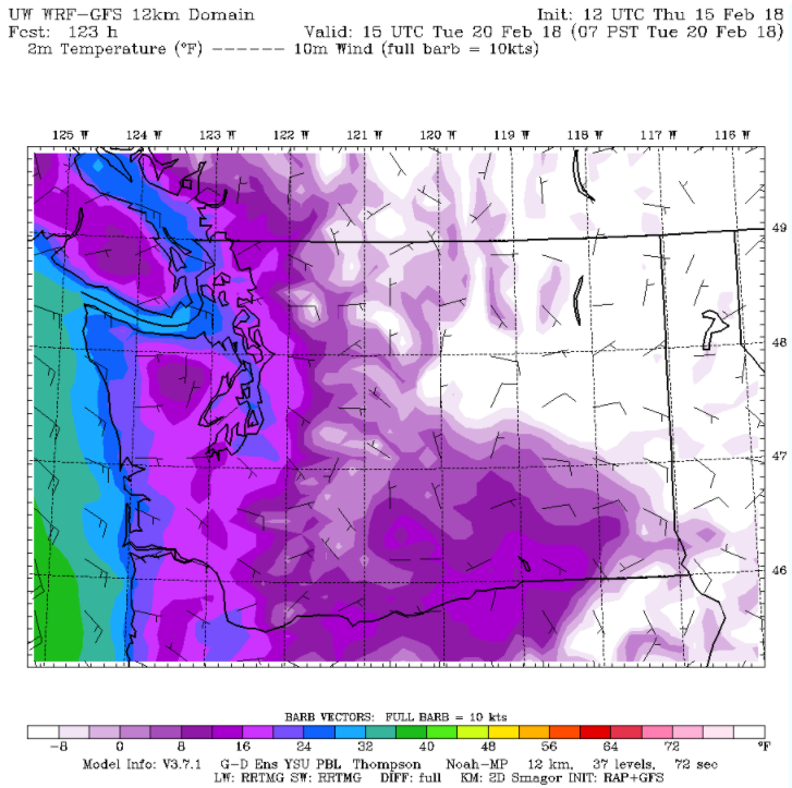
Bright blue skies will then dominate the scene once the sun rises on Monday, but temperatures will have a tough time climbing out of the mid-30s as we remain in the crosshairs of Canadian cold. Nightfall will likely bring the coldest temperatures of the winter, with the mercury plunging in the 20s or even the teens by Tuesday morning. This will be the best chance for Seattle to end its seven-year record low temperature drought, as the current record low for Feb. 20 is just 25 degrees (from 1955).
We’ll start to warm up a little bit by Tuesday afternoon, with afternoon highs making a run at the 40-degree mark—still a solid 10 degrees below late-February norms. With no clouds expected, however, overnight lows will sink below freezing once more, dropping into the mid-20s by Wednesday morning. The record low for Feb. 21 is also 25 degrees (from 1957)—another mark we could easily beat as the stubborn cold hangs on another day.
Just when exactly will our bout with frigid weather come to an end? Today’s models call for a slow moderation in temperatures starting Wednesday afternoon as cloud cover thickens—which should hold overnight lows above freezing in most places. Daytime highs will take a jump too, creeping into the mid-40s—still cold, but nothing like we’re expecting earlier in the week.
When—at long, long last—new record low temperatures could actually be set.


[…] airport dipped to 26 degrees—smashing the previous daily record low of 30 degrees (set in 2005). That’s the first time since Feb. 25, 2011 that the city logged a record low temperature—with 69 high temperature records set or tied during […]